
The old part of Ohrid was an island - the lake spread wider, the research showed
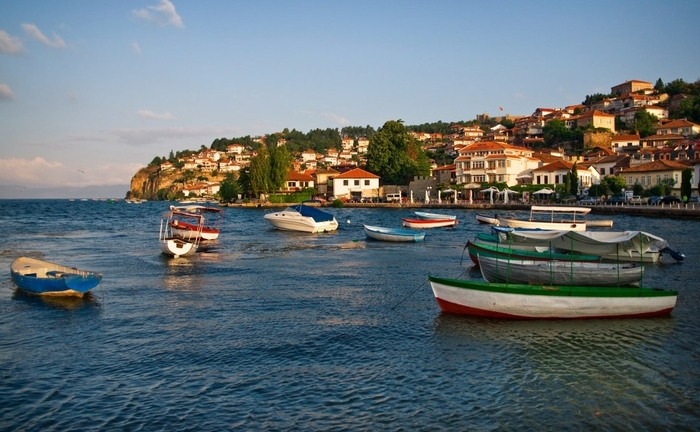
The old part of Ohrid or ancient Linchidos was an island in the period from the Late Bronze Age until the arrival of the Romans. This is shown by the geological and archaeological research carried out within the framework of the five-year project "Border studies, research on identities and cultural contacts in the border region of Ancient Macedonia".
The project was implemented by the Archaeological Museum of Macedonia and the Institute for Classical Studies from Charles University in Prague, in partnership with the German Archaeological Institute, the Geological Institute in Prague and the University of South Bohemia from the Czech Republic, as well as the Institute for the Protection of Cultural Heritage and Museum from Ohrid.
The head of the project, Pero Ardzhanliev from the Archaeological Museum of Macedonia, explains in a conversation for MIA that with the geological investigations in the plain, i.e. the part where today's modern Ohrid is located, they discovered lake sediments, which proved that that part was flooded.
– And that is not accidental. When we later thought about where most of the archaeological remains from the late Bronze Age to the arrival of the Romans were concentrated, we concluded that it was in the area of the old part of Ohrid. The settlements and necropolises from the ancient period are located exactly in that area, because the lowland was flooded, that is, it was part of the lake. According to that, we concluded that we should look for the settlements on the first row of hills in the background of the plain where we also carried out the excavations of the sites, pointed out Arjanliev.
The Ohrid-Strusa region had a stormy climatic past
As part of the archaeological research, Ardzhanliev adds, this year the emphasis was placed on three localities in the Ohrid area: "Petkina Niva" and "Gorica" near the village of Leskoec and "Gradiste" near Dolno Lakocherej. At the "Petkina Niva" locality, a Roman rural villa was discovered, at "Gradiste" a settlement with a chronology from the Late Bronze Age to the Hellenistic period, and at "Gorica" there is a chronology from the Neolithic to the Iron Age.
Most of the artifacts at all sites are ceramic findings, which according to the expert, are good for dating.
- The project is multidisciplinary, we had a team of archaeobotanists, who with special equipment wash the earth and collect all the archaeobotanical remains of the earth, seeds and various other remains with the help of which reconstruction of the landscape is carried out, what people ate, what they grew, etc. . With the help of carbonized organic remains, we perform radiocarbon analyzes in reference laboratories where we obtain accurate dates for each of the layers where we also discover archaeological artifacts. Thus, instead of a relative one, we get an absolute chronology, where the archaeological artifacts are in absolute dates, explained Arjanliev.
The goal, according to him, is to reconstruct the organization of settlements in the past.
- Within the framework of the project, we are carrying out multidisciplinary and geological investigations, with the help of which we realized that this end of the lake region had a stormy, dynamic climatic past. By reconstructing that stormy past, we can also reconstruct the organization of the settlements and how people organized themselves in the past to live around the lake and in the region, the interlocutor points out.
The beginnings of metallurgy next challenge
The basic resources for food were produced by themselves, that is, people in that period were engaged in agriculture and animal husbandry, but the future challenge of archaeologists is to investigate when metallurgy began.
- In the future, we plan to put emphasis on research when metallurgy started. We plan to do it multidisciplinary, with the help of advanced research. With the help of pollen analysis, we will find out when pollution began to occur in the past, and based on that pollution, then the specialists determine that it was during that period that metallurgy, ore smelting, etc. began, informs Arjanliev.
With that, he emphasizes, we want to give an answer for the appearance of the elite in the Ohrid region, as shown by the discoveries from the Archaic period (6th century BC) in the graves in Trebenishta and Gorna porta.
- In order to have an elite and such wealth, there must be more resources, I mentioned agriculture, animal husbandry and metallurgy, but in addition to those resources, these people also controlled the main communication and trade routes. And the region in that period represents a kind of crossroads in this part of the Balkan Peninsula, something that can be noticed from the large number of necropolises from the Archaic period, which were discovered in the plain north of Lake Ohrid, in which quite rich and significant findings were discovered. Today, it is the Ohrid-Strusa region, the coast of the then larger lake, which we geologically confirmed existed, Ardzhanliev said.
A cataclysmic event caused the retreat of the lake
With a geological probe near the Grašnica river, he added, they discovered a new stilt dwelling, which confirmed that there was a cataclysmic event, such as an earthquake, which contributed to the cessation of existence of that settlement around the 12th century BC, in the Late Bronze Age. time.
- Most likely, with that cataclysmic event, there was a lowering of the ground in the northern part of the Ohrid plain, and then the lake flooded, which changed its shape. They are initial results, which we will further upgrade and publish, informs the head of the project.
Beginnings of the project
The project "Border Studies. Researches of identities and cultural contacts in the border region of Ancient Macedonia", according to him, he started from scratch. For the first two years, they made visits to known localities, indicated in an archaeological map, and in conversation with the locals they also discovered new ones. All these localities have been geo-referenced in space, with which a variety of analyzes can now be made for the ratio between most localities in the region.
– It is much easier to see from a chronological framework how the localities are placed in the landscape. We began to get a picture of how we should continue the project and realized that the Ohrid plain depends on the dynamics of the lake and the rivers that flow into it. We realized that it is very difficult to discover the sites in the lowlands because there are large river drifts with a height of three meters, and also the erosion from the surrounding hills is very strong, says our interlocutor, the head of the project.
Then, in cooperation with the Geological Institute from Prague, they made a series of geological surveys, geological probes, profiles, examined the extracted sediments and then got the picture that Lychnid was an island and that the rest of the settlements were organized and placed on the first row of hills in the background of the flooded plain.
The last phase, carried out last year and this year, consisted of archaeological sounding research at certain locations where they assumed that they would give the best archaeological results. Probing archaeological excavations were carried out on these sites and the results confirmed the expectations.
- Archaeobotanists from the University of South Bohemia from the Czech Republic were also part of all our research, and all materials such as seeds, pollen and other remains will be analyzed in their laboratory, where we expect results that will support our research. The found artefacts will be deposited in the Archaeological Museum of Macedonia, where the analyses, their conservation, systematization will continue and if any object is useful, it will be placed in the showcases of the Museum, Ardzhanliev added.
Future plans are to continue research in the Prespa region
New questions emerged from the project that archaeologists need to answer. The idea is to continue research in the Prespa region, as it is the least explored.
- I am researching a necropolis in Prespa from the Hellenistic period, locality "Gibavica" near the village of Izbishta. And we have some initial knowledge about the Hellenistic period. But as for the Ohrid region that I said is closely related to the water level of the lake, we believe that we should expect the same in Prespa, because the two lakes are like connected vessels and we see that they are correlated. We plan to continue with the geological research and try to carry out sounding research on some localities so that we have two reference images of the two basins to see if they are really correlated and if there was a connection in the past, adds Arjanliev.
The project, he emphasized, uses advanced technology available to archeological science, which unfortunately is very little involved in the country.
Sladjana Stojkova Kostoski/MIA